webcams Paris

Webcam Live Dio-et-Valquières

« »
Météo Dio-et-Valquièrese
7 775 views


Géography
Place Dio-et-Valquières - Occitanie - France
Latitude 43.6661632
Longitude 3.2137642
Altitude 437 meters
Orientation
Good to knowr
Owner Grand Orb
Camera AXIS
Visitors 7 775 visits
Specificity
Format 720P 360°
Category Nature, Météo


Informations

Grand Orb is a community of municipalities located in the Hérault department, at the heart of the Haut-Languedoc Regional Natural Park.
This area comprises 24 municipalities and offers a great diversity of landscapes, including mountains, valleys, forests, and garrigue.

Its natural heritage is rich, featuring remarkable sites such as Lake Salagou, the Espinouse Mountains, and the thermal springs of Avène and Lamalou-les-Bains.
The region is ideal for numerous outdoor activities, including hiking, mountain biking, climbing, paragliding, and thermal spa treatments.

Grand Orb’s territory is also marked by an ancient history, visible through its medieval villages, castles, Romanesque chapels, and industrial heritage linked to former mines and textile mills.
The Château de Dio, classified as a historic monument, is one of the architectural gems of the region.

The local economy is based on several key sectors: agriculture (vineyards, livestock, market gardening), craftsmanship, tourism, and renewable energy.
The wind farm in Dio-et-Valquières, for example, produces enough energy to power more than 4,200 households.

Grand Orb also stands out for its cultural vitality, with festive events held throughout the year, including festivals, markets, fairs, and performances.
The thermal spa resort of Lamalou-les-Bains attracts many visitors seeking well-being and specialized treatments.

With its exceptional living environment, blending preserved nature and economic dynamism, Grand Orb is an attractive territory both for its residents and for those looking to settle there.

L'Orb

The red lands of the Orb offer a spectacular and unique landscape, characterized by ruffe formations—clay-rich soils high in iron oxide that give them their intense red hue.
They extend mainly around Lake Salagou and in the Orb Valley, creating a striking contrast with the blue sky and the green of the surrounding vegetation.

These unique landscapes are the result of an ancient geological history, dating back more than 250 million years when this region was covered by lagoons and shallow seas.
Erosion has sculpted these gently rolling hills, making the site particularly photogenic and appreciated by nature lovers and hikers.

The red lands of the Orb are also a fragile ecosystem, where vegetation has adapted to the arid soil conditions: green oaks, Mediterranean shrubs, and drought-resistant plants gradually colonize these areas.
A discreet yet diverse fauna can also be found here, including ocellated lizards, birds of prey, and insects specific to warm environments.

This region is ideal for many outdoor activities such as hiking, mountain biking, and exploring the ancient volcanoes of Escandorgue.
Nearby villages, such as Dio-et-Valquières, offer remarkable architectural heritage, blending medieval remains with local stone constructions that harmonize with this unique environment.

The red lands of the Orb are thus a true natural gem of the Languedoc, combining wild beauty and historical richness, to the delight of those passionate about rare and preserved landscapes.


Archives

Last Hour

3 Last Hours

6 Last Hours

12 Last Hours


Dio-et-Valquières

Presentation

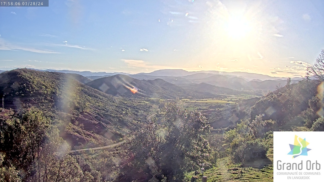
Dio-et-Valquières emerges from the red lands of Salagou and is located at the foot of the Escandorgue volcanoes, sheltered by white limestone cliffs.
This commune in the Hérault department consists of three small hamlets: Dio, Valquières, and Vernazoubres.

The landscape is diverse, combining ruffes (red earth valleys), chestnut groves, and the wild plateau of Pioch.
Four streams cross its territory: the Vernoubrel, the Garel, the Nombringuières, and the Brayou.
Located in a low mountain area, it is exposed to the north wind and the sea breeze.
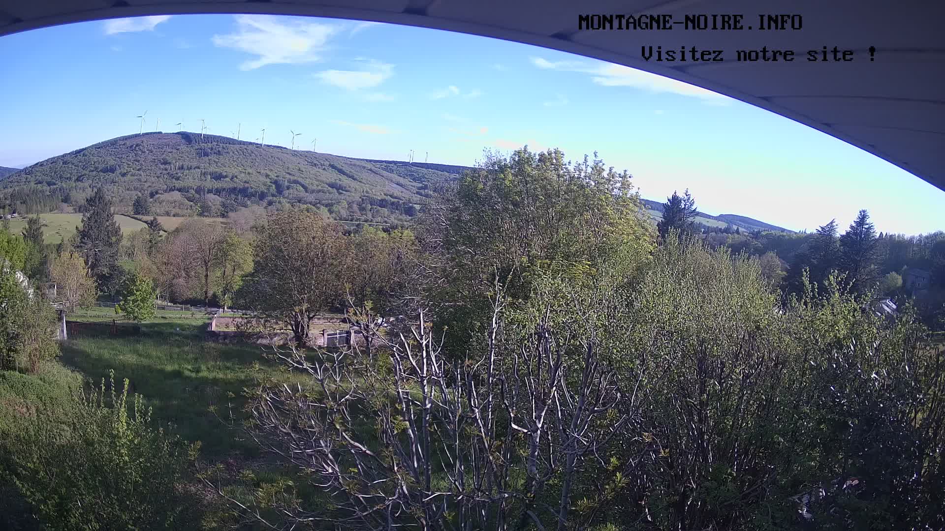
Its highest altitude of 701 meters makes it an ideal location for paragliding.

With its numerous hiking trails, Dio-et-Valquières is perfect for walking, horseback riding, or mountain biking.
The stunning GR7 trail passes through the commune, dotted with dry-stone huts and crosses, following the footsteps of Saint James' pilgrims.
This path leads to Valquières, where beautiful medieval houses are grouped around a 12th-century church, covered with authentic lauzes and accessible via a stone-paved alley.

Further on, Vernazoubres nestles in a wild mid-mountain landscape, surrounded by chestnut trees and bordered by the Vernoubrel stream.

One of the jewels of the commune is the Château de Dio, an imposing fortress overlooking the village.
Its history dates back to the Visigoths and continues until the 17th century when it was renovated by the family of Cardinal de Fleury, a minister of Richelieu.
Classified as a historical monument, it hosts the "Les Médiovales" festival every year at the beginning of August.
This event brings the Middle Ages back to life with knightly battles, storytelling, games, theatrical performances, pony rides, catapult launches, and traditional paper-making demonstrations.

In terms of renewable energy, Dio-et-Valquières stands out with its wind farm, which supplies around 4,247 households, including heating.

With its exceptional living environment, combining nature and history, the commune offers a peaceful and welcoming atmosphere, ideal for both professional and leisure activities.

Location


Points of interest

Last snapshot


Near